
There is such a continent in the world, and there are boundless lakes here; There is a dense rainforest here; There are sacred and ancient rivers here; There is the longest rift valley in the world, and it is these unique natural environments that have bred the ancient civilization and immortal magic of this continent, and today we will take you into this magical continent ---- Africa.
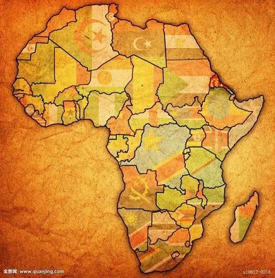
Africa, full name Afrika, is located in the southwestern part of the Eastern Hemisphere, with parts of the northwest jutting into the Western Hemisphere. It is bordered by the Indian Ocean to the east, the Atlantic Ocean to the west, the Mediterranean Sea and the Strait of Gibraltar to the north and Europe to the northeast, and Asia to the northeast with the narrow Red Sea and the Suez Canal. With an area of about 30.2 million square kilometers, Africa is the world's second largest continent after Asia. There are currently 55 countries and regions, which are geographically divided into five regions: North Africa, East Africa, West Africa, Central Africa and Southern Africa. The distribution of water resources in Africa is extremely uneven, with the Central African region having 50.66% of inland water resources, while the North African region accounts for only 2.99%.
These limited water resources have brought this magical continent to life. When one thinks of Africa's rivers, one first thinks of ---- Nile.
1, the Nile
The Nile runs through eastern and northern Africa, running from south to north across half the continent for about 6,670 kilometers, making it the longest river in the world. After nearly 10,000 years of history, many splendid civilizations have been bred on both sides of its shores and a large number of amazing buildings have been created. Their fate is tied to the Nile, but no one has ever been able to dominate it.

The Nile has two headwaters, one originating in the mountainous region of tropical Central Africa, the Black Nile. The other originated in the Ethiopian Highlands. It's called the Blue Nile. It is ultimately believed that the true source of the Nile is the Burundi Plateau.
The Blue Nile, which is about 680 kilometers long, turns sharply down Lake Tana and forms a stream of water that forms the second most famous waterfall in Africa, the Tisset Falls. Most of the water and nutrients in the Nile come from the Blue Nile.
The White Nile originates in the rainy zone of the equator and has a rich and stable water supply. It flows through Uganda in a short channel, known as the Victoria Nile, and after the calm water meanders for tens of kilometers, the river narrows to form a bottleneck-like channel, and the river is all swept into a canyon only 7 meters wide, and the river falls steeply. Formed here is Murchison Falls or Murchison Falls National Park, which is the largest national park in Uganda and is located in northwestern Uganda. The river flows westward here, into Lake Albert, where it flows out of Lake Albert and begins to head north, known here as the Albert Nile. The Albert Nile flows through the Nimurai Gorge and enters the Sultan Plain. Since then the river has been renamed the White Nile.


The Blue Nile and the White Nile converge in Khartoum, the capital of Sudan, to form the Nile. Among the countries through which the Nile River flows, Sudan has superior natural conditions and abundant water and soil resources. The Nile flows about 3,300 kilometres through the Sudanese border, almost half the length of the country, and almost all of its important tributaries converge in Sudan. The Republic of the Sudan is the third largest country on the African continent, and the economic structure of the Sudan is dominated by agriculture and animal husbandry, and the export value of agricultural and animal husbandry products accounts for more than 90% of the total export value. At the same time, Sudan is also rich in tourism resources. The Red Sea coast of Sudan stretches for more than 700 kilometres with a pleasant climate. Travelers can enjoy the refreshing bays and gorgeous coral reefs here. Khartoum, the capital of Sudan, is a fascinating city, especially the peculiar landscape at the confluence of the Nile River, which attracts a large number of tourists every year and is a famous tourist attraction in North Africa. There is a confluence park on the east bank of the bridge across the river at the confluence of the blue and white Nile rivers, standing on the bridge of the park overlooking the white river, the water of the Blue Nile is blue, and the water of the Nile at the confluence is half white and half blue, and the scene of one river and two colors is spectacular.
The White Nile originates in the rainy zone of the equator and has a rich and stable water supply. It flows through Uganda in a short channel, known as the Victoria Nile, and after the calm water meanders for tens of kilometers, the river narrows to form a bottleneck-like channel, and the river is all swept into a canyon only 7 meters wide, and the river falls steeply. Formed here is Murchison Falls or Murchison Falls National Park, which is the largest national park in Uganda and is located in northwestern Uganda. The river flows westward here, into Lake Albert, where it flows out of Lake Albert and begins to head north, known here as the Albert Nile. The Albert Nile flows through the Nimurai Gorge and enters the Sultan Plain. Since then the river has been renamed the White Nile.

After the confluence of the Green and White Nile rivers in Khartoum, they flow through tropical deserts with arid climates. In order to make full use of the Nile's water resources, the Aswan High Dam was built at the First Waterfall in 1970. The Aswan High Dam reservoir spans the two countries of Egypt and Sudan, and it is known as Lake Nasser in Egypt. The artificial cofferdam of the Aswan High Dam Reservoir reduced the flooding of the Nile River downstream, but also the biological resources formed with the flood overflow. But it has provided Egypt with sufficient electricity resources and has given it direct control over its most precious water resources.


The Nile River flows into Egypt and forms an estuarine delta with an area of about 24,000 square kilometers near Cairo in northern Egypt. The Nile Delta looks like a lotus flower, hence the name "Flower of the Nile", which makes this desert wasteland rich and beautiful. Egypt is one of the four ancient civilizations in the world, it is located in the northeast of Africa, across Africa and Asia. Egypt is the most populous country in the Middle East and the second most populous country in Africa, and has long been in Africa's leading position in the economic, scientific and technological fields. During the Roman Empire, Egypt was one of the important trading partners of the ancient Silk Road. At the same time, it is also one of the African countries that have been included in the "Belt and Road". The Nile is the mother river of Egypt. Without the Nile, there would be no great pyramids, no innovations and civilizational advances in its language or astronomy. The Egyptian civilization was formed in the Nile Valley and was the earliest civilization of mankind. If you walk into Egypt you will be moved by the ancient civilization of 7,000 years, and you will be shocked by the diversity of cultural and historical traditions. It is full of world wonders and the pinnacle art of humanity---- the pyramids, the Sphinx, the Karnak Temple, the Alexandria Lighthouse, and the Siva Oasis in the Sahara. The unique style they exhibit is closely related to the Nile. But no matter how much life changes on the shore, the Nile has always been Egypt's eternal and unchanging existence. This long river of history, its entire basin is regarded as the greatest cultural heritage of mankind.
2, the Congo River
Leaving the Nile, let's walk into this little-known and extremely mysterious river in central Africa---- the Congo River. The Congo River, also known as the Zaire River, is one of the few places in the world that has not yet been fully developed by humans. The Congo River originates in Zambia and flows through the equator and tropical rainforest through the African hinterland to the Atlantic Ocean. The Congo River is a river that can swallow everything, with a total length of about 4700 kilometers, and its length is second only to the Nile, making it the second longest river in Africa. However, its basin area and flow rate are ranked first in Africa, and it ranks second in the world after the Amazon River in South America.
One such place on the upper Congo River is the Banveulu Marsh, where the animals that move with the lake and the sun make up the unique beauty of the African continent. In the local language, "Ban Wei Ulu" means the place where water and sky meet. Water creates waterways and islands in the swamp.
In the late 9th century, the whale-headed stork was first discovered here, and little has ever been known about the bird, and it was only recently that records of the whale-headed stork were found in ancient Egyptian hieroglyphs. The whale-headed stork is reminiscent of Archaeopteryx, which has survived on Earth for tens of thousands of years with its extraordinary hunting skills. The Banweglu Swamp is the only place in the world where black donkey antelopes can be found, and there are about 500,000 black donkey antelopes living here. The animals flying in the sky and the animals running on land make up a beautiful scene. The Ban Wei Ulu Moor, Lake Ban Wei Ulu and the Ban Wei Ulu Plain together make up the world's largest wetland system and one of the most important ecosystems in the world – the Ban Wei Ulu Wetland System.
The middle reaches of the Congo River have many tributaries, a dense network of rivers and abundant water. Here the Congo Basin, one of the world's top ten basins, was formed. It also gave birth to the Congolese rainforest with an area of about 1.8 million square kilometers, known as the lungs of Africa, with winding waterways connecting different areas of the tropical rainforest. This dense jungle is the area with the largest number of primates in the world. Bonobos, chimpanzees and gorillas can be found in this rainforest, meaning that primates other than orangutans can be found here. This is the only habitat for gorillas.
There is a group of people who think that gorillas are the embodiment of humans, that all their food comes from the forest, that they have lived in this rainforest for thousands of years, and that they are the Baka people. The average height of the Baka people is only 130 centimeters, and they do not settle in one place when they move around in the forest. The Baka were able to accurately determine the type of animal by their keen sense of sight and hearing. For living in the jungle, the Baka people have a wealth of knowledge and experience. They are treating the forest in their own unique way. They understand and respect nature. Perhaps only they know the forest best.
Most of the Congo Basin is in the Democratic Republic of the Congo, the Democratic Republic of the Congo for short, located in west-central Africa, with the equator running through the north. The Congo River flows here for more than 1,000 kilometers. The Democratic Republic of the Congo is rich in natural resources and is known as the "world's raw material warehouse". The country reserves a variety of non-ferrous, rare metals and non-metallic minerals, and the reserves of other mining resources are: oil, natural gas, coal. Forest cover is 53 per cent, half of Africa's tropical forest area. It is rich in 22 kinds of precious woods such as ebony, mahogany, rosewood and yellow lacquered wood. The Democratic Republic of the Congo is rich in hydrological resources, with estimated reserves accounting for 40 per cent of Africa's total reserves and 13 per cent of the world's.
From here, the river flows downstream, first crossing more than 100 kilometers of canyon area, the width of the river shrinks to less than 400 meters, and the narrowest point is only more than 200 meters, forming a series of waterfalls, which form the world-famous Livingstone Falls Group. The Congo River has many rapids and waterfalls, and is extremely rich in hydropower resources. According to incomplete statistics, there are 50-60 waterfalls on the main trunks and tributaries. Its hydroenergy reserves account for one-sixth of the world's total known water resources, but they have not yet been developed on a large scale. There are no deltas at the mouth of the Congo River, only deeper valleys, and the trough extends up to 150 kilometers to the bottom of the Atlantic Ocean, within tens of kilometers of the estuary, forming a vast freshwater ocean. It is the only deep-water estuary among the great rivers in Africa and is conducive to the development of shipping. The Congo River is the heart of Africa, the Congo River basin still preserves ancient traditions, legends of wonderful creatures, and here is the last legacy of our blue planet, and we will spare no effort to protect it.
3. The Niger River
Next, I'm going to introduce you to the playful Niger River. The Niger River, about 4,200 kilometers long, is the third longest river on the African continent, among the several large rivers flowing in Africa. Known as the "mother river" of West Africa, what distinguishes the Niger River from other rivers is not its length, but the direction of its currents. The Niger River originates from the Futagallon Plateau in southern Guinea, and like a naughty child, it willfully bids farewell to the Atlantic Ocean that is close at hand and turns around and rushes to the Sahara Desert in the distance, which brings life to arid land and provides a source of growth for civilization. When it flowed to the desert hinterland and seemed to be going to return, it tactfully reversed its direction and re-embarked on the journey back to the Atlantic. Eventually plunged into the Gulf of Guinea. For those living in Niger and on both sides of the strait, it is a gift from the gods and an irreplaceable source of life.
The upper reaches of the Niger River are in tropical rainy areas, rich in water conservancy resources and turbulent currents. The annual precipitation in this section is 1500 to 2000 mm. Evaporation is exuberant in most areas of the middle reaches of the Niger River, and despite the infusion of the Barney River, the flow of the main stream has decreased slightly, and the average annual flow measured when the Niger River reaches Niamey has decreased by nearly a third compared with that of the upper reaches. When the Niger River reached the vicinity of Makara, it was supposed to flow all the way north. However, due to changes in the earth's crust, a highland raised north of Macala, but its northeast sank, so the Niger River was diverted to flow northeast, and about 1 million hectares of inland delta formed along the old channel, which gradually dried up and became barren, so it was called the "dead delta".
The Niger River flows northeast from Makara and circles more than 1,000 kilometers north in Mali, forming a natural connection between tropical Africa and Saharan Africa, Mali was once the center of three important ancient civilizations in West Africa, namely the Ghana Empire, the Mali Empire and the Songhai Empire, which were influenced by the Sahara trade routes. The Niger River forms a 3.6 million-hectare delta in Mali's stronghold of Mapte, which is rich in water and fertile land, known as the "Living Delta". It is the main agricultural and pastoral area of Mali and the most economically developed area in Mali. Mobodhi is a cargo hub in Mali and even in West Africa, where goods from all over the world are collected and then transshipped to other regions. For most of the year, the port of the Mobodhi River is a thriving sight. People regard this city, which is tightly embraced by the Niger River and its tributary, the Barney River, as the Venice of Mali. Thus Mobodhi's shipbuilding industry was very well developed, and in several shipyards along the river, ships were manufactured entirely by hand. The annual flood brings a wealth of fish to Mobodhi, and Mobodhi is soaked in the fishy smell. Interestingly, there are far more dried fish in Mobodhi than fresh fish, and in the hot climate of Mali, smoked dried fish is not a good way to preserve. The smoked dried fish produced here is not only trafficked to Mali but also exported to Ghana and other countries. In addition to fishing, Mali is also rich in mineral resources such as gold and diatomaceous earth.
The lower reaches of the Niger River, which flow through rain-rich areas, are rich in water. The Federal Republic of Nigeria, located in the middle and lower reaches of the Niger River in southeastern West Africa, is the last country through which the Niger River flows. With a population of over 100 million, it is the most populous country in all of Africa. Africa's ethnic group is usually considered to be more than 300, and Nigeria embraces most of them and is the country with the most complex ethnic composition in Africa and even in the world. There are more than 250 tribes in Nigeria, all of which have their own languages, customs and habits, and they have formed a colorful national culture here. Therefore, Nigeria has the reputation of "the cradle of black African culture". Just near the mouth of the Niger River, numerous tributaries have sprung up, forming the Niger Delta of about 36,000 square kilometers in the south of Nigeria, which is the last gift it has given to this land on the way of more than 4,000 kilometers, and the delta formed by these tributaries is rich in shallow oil. Nigeria's most famous oil field ---- Port Harcourt. Nigeria has long been an agricultural country, and since the 1970s, the oil industry has sprung up, making Nigeria Africa's largest oil producer. Along with the development of other industries, the Niger River used to be known as the Golden River due to its abundance of gold. Even if it will merge into the sea today, it still proves the good name of the Golden River, and the people who own this great river are happy, because under its nurturing all dreams have the hope of coming true.
4, Zambezi River
The Zambezi River, the original meaning of the name "Great River", the Zambezi River through southern Africa gave life to this ancient continent. Its source is hidden in the dense forests of the highlands of northwestern Zambia and eventually flows into the Indian Ocean. With a total length of 2,660 kilometers and a basin area of 1.35 million square kilometers, the Zambezi River is the fourth largest river in Africa. Although humans are now able to use its water resources, the Zambezi River remains intact. The Zambezi River is the least famous of the four major rivers in Africa, but the long journey of this river reflects its vitality, and its story is equivalent to the story of Africa.
The Zambisi River originates in the Zambian Highlands, and Zambia is named after the Zambezi River. Zambia, known as the "country of copper mines", has more than 900 million tons of copper resources, which are concentrated in the basin region of the upper Congo River in the northeast, because this area is rich in copper, so it is called the Copperbelt Province. The development of copper mines has led to the emergence of many cities and a large population here. It is said that more than 3/5 of Zambia's urban population is concentrated in Copperbelt Province. With the development of the mining industry, Zambia's tourism industry has gradually flourished. It is often said that if you don't go to Zambia without copper mines, you are just like going to Egypt without visiting the pyramids, and you don't climb the Great Wall in China. The copper mine in Humbich was funded by the China Nonferrous Metals Construction Group. In 1998, it invested 20 million US dollars and bought 85% of the shares. Another $150 million was invested in the reconstruction here. The copper ore trade is Zambia's main economic income.
In the upper reaches of the Zambezi River, its headwaters are scarce, and countless small tributaries and continuous underground seepage have contributed to the river's water flow to become larger and faster. The Zambezi River flows south through Zambia's forests, and here in Angola the rivers meander from the edge of the forest, the only remaining major habitat for the Great Black Gazelle.
Hundreds of kilometres from its source, the Zambezi River flows into Zambia, where the river changes direction and chises through vast grasslands, the Willow Plain of Willows. The formation of this plain is due to the Zambezi River. During the dry season, the course of the Zambezi River contracts, and the plains are littered with golden grass. When the rainy season arrives in November, the original golden grasslands turn into shallow inland seas, and the water everywhere you look as if the Zambezi River has also been flooded. During the rainy season, some sections of the Zambezi River are more than 25 kilometres wide. The Zambezi River, which floods once a year, dominates everything and nourishes the land with water.
The abundant Zambezi River and the Great Rift Valley combine to create Victoria Falls. The rushing Zambezi River crashes here, creating a natural wonder of immense power. The thunderous sound of the waterfall can be heard from a distance of ten kilometers, and the locals vividly turn the waterfall into Mosiotunia, meaning thunderous smoke. As early as the 19th century, it was listed as one of the 7 wonders of the world. Africans say it is a symbol of Africa, it represents the power of nature. Not far from Victoria Falls is the Victoria Iron Bridge, which spans the Great Rift Valley, a passage connecting Zimbabwe and Zambia, and the middle of the bridge is the border between the two countries. Victoria Falls is now the largest source of tourism revenue for Zimbabwe. Known as a paradise, Zimbabwe is an ordinary landlocked country. The light gauze soil, which covers 1/3 of the country's land area, and the annual rainfall of 600-800 mm, make Zimbabwe a fertile soil suitable for the growth of a special plant, which is tobacco. The criterion for judging the quality of tobacco is the ratio of nicotine content to sugar, and the currently recognized optimal ratio is 1:6, and Zimbabwe's tobacco leaves are very close to this value, so world-renowned cigarette manufacturers like to add a part of Zimbabwean tobacco leaves to their products to adjust the taste. Now the tobacco industry is the largest industry in Zimbabwe, it accounts for 1/3 of Zimbabwe's foreign exchange earnings, 6%-12% of Zimbabwe's gross national product every year comes from the income of the tobacco industry, and the EU is the largest consumer of Zimbabwe tobacco.
The Zambezi River crosses the Kariba Gorge in the middle of the river, and the energy of the river is weakened and the flow slows down. In 1955, new forces played a role in this ancient land, and the government decided to build a dam in the Kariba Gorge. The dam was completed in 1959 and the Kariba Reservoir was completed. The maximum dam is 128 meters high, and the total reservoir capacity is 184 billion cubic meters. The year after the Zambezi River was intercepted, the Zambezi River began to generate electricity and water supply to this day. When the reservoir was built, the Zambezi River seemed to be cut in half, and the tranquil Kariba Reservoir stretched 280 kilometers upstream.
The Zambezi River continues to flow downstream, dividing into seven triages before entering the sea, forming a delta of about 6,500 square kilometers in Mozambique, where the Zambezi River eventually empties into the Indian Ocean. In the chronology of the Zambezi River, the presence of humans is only a small part. The Zambezi River still dominates the creatures along the river, and creatures are still struggling to survive. The Zambezi River is as wild and untamable as the African continent.
5, The Great Rift Valley
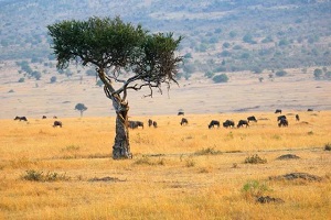
These four great rivers of Africa nourish this magical land, and all three rivers except the Niger River are closely related to this region. That is the Great Rift Valley, known as the "scar of the earth". The Great Rift Valley is more than 6,000 kilometres long and stretches from the northern tip of the Red Sea to Lake Malawi, with numerous gorges, lakes, volcanoes and aquatic plains along the way. About 30 million years ago, hot lava continued to gush out from the depths of the earth's crust, and this fascinating land was born. The majestic Great Rift Valley is a masterpiece of nature's ingenuity, and the land from Mount Kilimanjaro to the Serengeti steppe is a haven for life and one of the birthplaces of human civilization.
In the northern part of the Great Rift Valley on the African continent, the climate here is hot, a world of sand, stone, salt and water. Many of the volcanoes scattered here are extinct, but volcanic activity continues in the Afar region near northeastern Ethiopia. The Afar region is like the beating heart of the Great Rift Valley. With an average annual temperature of 34.6 degrees Celsius, it is one of the hottest and most dangerous areas on Earth. Among the many volcanoes, the Ertaare volcano is more famous, and the lava lake inside its crater has been boiling continuously for at least 40 years. The volcano is located in the Danagil Depression, which has sunk below sea level, and Lake Asala, a crater lake, is also located in this depression. The lake is about 155 meters below sea level and is the lowest point in Africa.
The Great Rift Valley runs diagonally through the Ethiopian highlands. Ethiopia, formerly known as "Abyssinia", is a landlocked country in Africa, located in northeast Africa, one of the ancient African civilizations. The central bulge of its territory is known as the "roof of Africa". There are more than 30 large rivers originating from the central plateau, so it is known as the "East African Water Tower". Ethiopia has many mineral species, rich in geothermal and hydrothermal and forest resources. Ethiopia is also the home of coffee, where the best coffee in the world comes from. Most of it has a tropical rainforest climate. This excellent geographical environment and climate make the coffee here rich in a wine aroma with a strong chocolate aftertaste. The most famous coffee is Mocha Heights coffee. Therefore, Ethiopians often treat guests with coffee, which is a more solemn etiquette. Ethiopia is also very rich in tourism resources, the most famous of which is the Lalibela Cave Church. People usually look up at the church, and here it becomes looking down. These churches are located in huge deep pits of rock, and it cannot be said that it is a miracle in the history of human architecture. There is also the Obelisk of Axumkao, a representative of the ancient Ethiopian civilization----; Semen National Park, etc. These resources have not yet been fully exploited, and there are huge business opportunities.
The Eastern Branch Rift Zone
The Great Rift Valley divides into east and west branches near southwestern Ethiopia, with the Eastern Rift Valley being the main rift valley, along the east side of Lake Victoria, north through central Tanzania to the Red Sea and finally reaching the Jordan Valley, with a total length of nearly 6,000 kilometers. The Great Rift Valley drifted several kilometres eastward, pushing up and gathering in Kenya to form what is now the Tuggen Mountains. The inhabitants here are extraordinary, and almost all of them start running at sunrise, resulting in the birth of many world long-distance running champions. Most of the world's top 100 marathon runners are from Kenya, most of them from Kenya's Rift Valley province.
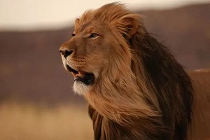
Lake Nakuru National Park in Kenya was established to protect birds and is home to the world's largest bird habitat. There are about 450 species of birds that inhabit the area, the most famous of which is the flamingo. Kenya is a famous tourist country in Africa, Kenya has more than 30 natural animal nature reserves, accounting for 15% of the country's land area, in Africa has the reputation of a wildlife kingdom. The Masai Mara Nature Reserve on Kenya's southwestern border is home to the largest wild mammals in the world, and we come here as if we have entered a world full of life legends.
Kenya is not only a paradise for animals, but also one of the birthplaces of human beings, and the area around Lake Turkana in northern Kenya is a world-famous fossil discovery site with a wealth of fossil reserves. In 1984, the famous Turkana Boy, the most complete Homo erectus skeleton, was excavated not far from here. Millions of years ago, not far from here, a group of primates embarked on an adventurous journey, first learning to walk upright, and then step by step into the world.
The Great Rift Valley continues to stretch southward, and the Natron Lake, located in the eastern part of the Great Rift Valley, is named for its alkali content, and the water here is very warm, up to about 50 degrees Celsius, and the evaporation of the lake also makes the lake contain high concentrations of minerals. The red lake water is a masterpiece of algae in the salt lake of Natron, located in the Ngorongoro Crater in northern Tanzania. Over time, the edge of the caldera continues to collapse under the action of erosion, forming a world-famous natural wonder. This appears to be the landing site of Noah's Ark, a land of about 260 square kilometers where almost all the animals of the African savannah are concentrated. The Ngorongoro Crater, while unique, is by no means self-contained and is part of the Serengeti ---- Mara ecosystem. Due to the change of seasons and the uneven distribution of rainfall, one of the most spectacular animal wonders on earth has been formed here – the Great Migration of Wildebeests, the migration of the Serengeti savannah. Crustal movement and volcanic eruptions have created the Serengeti savannah and the Masai Mara National Park, for us this land is not just an ordinary steppe, it is the essence of Africa, the masterpiece of nature, the home of dreams, the kingdom of animals.
West Branch Rift Belt
The Western Branch Rift Belt roughly runs along the west side of Lake Victoria from south to north through a series of lakes such as Lake Tanganyika and Lake Kivu, with a total length of more than 1,700 kilometers. It is home to volcanic formations with lush vegetation, and the southeast trade winds bring abundant precipitation, so the soil is fertile. Located in the middle of the Western Rift Zone is Lake Tanganyika, one of the longest freshwater lakes in the world and an inland lake. It is one of the largest freshwater reservoirs in Africa, and if the lake is drained, it will become the largest canyon on earth, with a total length of about 670 kilometers and a depth of about 1500 meters. The Mahal Mountains on the eastern shore of Lake Tanganyika are Tanzania's prized natural treasures, and Mahal National Park is home to nearly a thousand endangered species ---- chimpanzees.
On the other side of the Mahal Mountains, east of Lake Tanganyika, Ruaha National Park in central Tanzania is one of the largest nature reserves in the Great Rift Valley. The climate in this region is hot and arid, far from other scenic places in Africa. The Great Ruaha River is the source of animal life, which is why this national park is named. But just about 200 kilometers east of the Great Ruaha River, there is a dense rainforest. There is such a forest in the vast savanna, isolated for millions of years, which continues to this day, and the species evolution in the process is different from other regions, so there are many endemic species that are difficult to find anywhere else on the earth.
The East Branch Rift Zone and the West Branch Rift Zone are very different, the difference is in the hydrological situation, the East Branch Rift Zone has scarce water sources, most of them have degenerated into shallower desert saltwater lakes, the West Branch Rift Zone is distributed with dense rainforest, and has the world's second largest freshwater water, which is full of saltwater lakes and savannah, surrounded by dense forest mountains, these natural landscapes are diverse and different, and together they constitute the Great Rift Valley of East Africa. There are also many secrets hidden in the Great Rift Valley waiting for humans to explore, and in the face of the mysterious nature, we should do everything we can to protect it.
These silently flowing rivers have created a unique landform landscape in Africa and bred the world's richest animal and plant resources, and the resources they contain are waiting for us to develop and study. Africa is not just poor and backward, only when we really walk into it can we feel its unrestrained and wild beauty.

Scan Follow the official WeChat Get the latest news
Secretariat(Africa):Ms Chantal Carnow, tel:+27 21 959 2439 email: unescochair@UWC.ac.za
Prof. Thokozani Kanyerere email: tkanyerere@uwc.ac.za
Secretariat(China):Mr. Feng Jia, tel: 13935133050 email: 270191612@qq.com;
Ms Jihong Qi, tel: 13031980393 email: 44755900@qq.com
Address:Baoli Yazhou Bay, Yazhou District, Sanya City, Hainan Province